Dear Mr. President:
I ask you to consider releasing all NOAA and FBI data pertaining to the pilot hijacking of Malaysia Airlines MH370 on March 8, 2014. NOAA was among the first on the scene of the crash site above Zenith Seamount in the South Indian Ocean, and NOAA gave an Australian government employed scientist, David Griffin, an escorted voyage above the wreckage in June 2014.
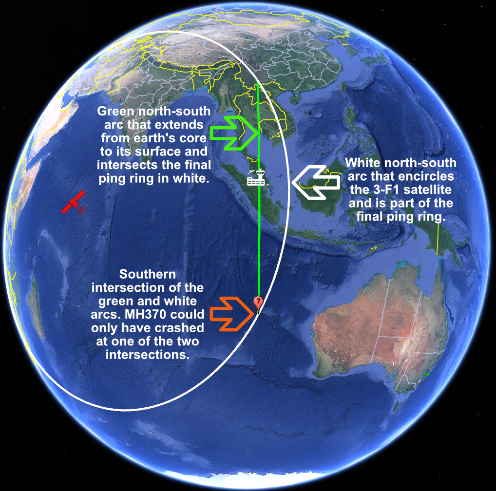
The plane is not missing. It was never missing. The pilot flew a circuitous route from Kuala Lumpur to the South China Sea, and then turned west and flew across northern Malaysia to the Strait of Molucca to the Bay of Bengal. From the northern Bay of Bengal, the pilot turned south and flew directly to the deepest hole in the South Indian Ocean. He then made a ‘controlled ditching’, as first confirmed by Canadian forensic investigator Larry Vance.
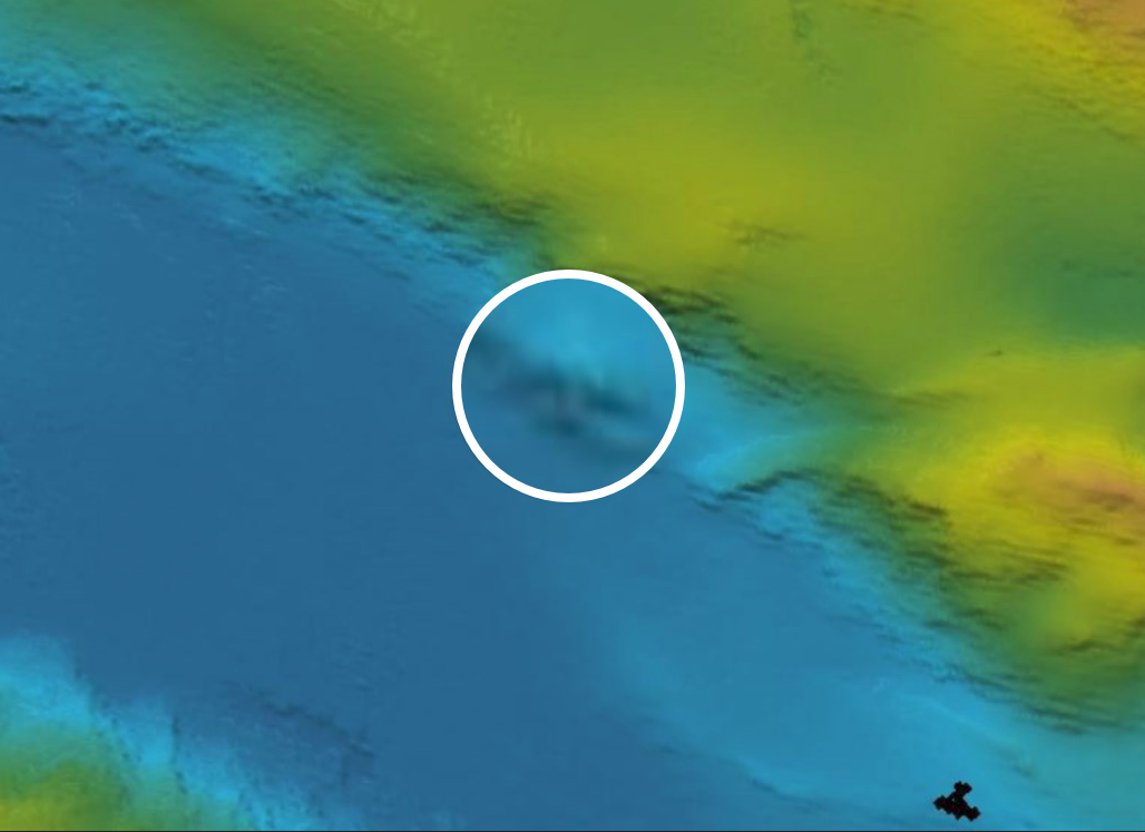
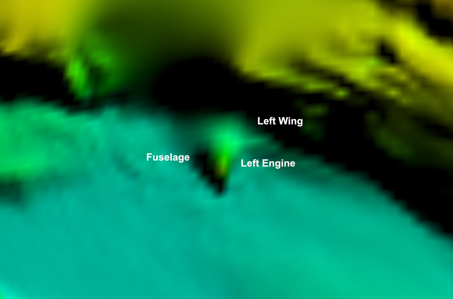
The airframe is physically located at GPS -22.2 S, 102.3 E in -7,400 meters of water. Robotic equipment is the only way to view it. The plane’s right wing was severed on impact and is resting about 20 km east of the fuselage in 5,000 meters of water. There is other ‘leading edge’ damage to wing and stabilizer surfaces, but as a whole, the plane remains a recognizable Boeing airframe.
The airframe has been filmed and sonared by Germany, Australia, and China, in that order. Perhaps others. Australia spent ten days documenting the crash site in May 2021. I can provide copies of all surface vessel movements in the Zenith Seamount area during the period.
There is nothing secret about MH370’s location or condition. With a simple Scripps plugin, Google Earth Pro includes Germany’s 2017 sonar of the debris field. Anyone on earth can view it. There are many other “in situ” images of the plane.
Closure of that tragedy is important for next of kin and for the integrity of the International Civil Aviation Organization. MH370 marks the first time a civil aviation member state has refused to cooperate in a tragedy involving loss of life.